Homepage - Mapware
Aerialapplications. Creator of Mapware, the smarter, faster, more powerful drone mapping software. Learn why Verizon and the US Air Force trust...
Read Aerialapplications.co news digest here: view the latest Aerialapplications articles and content updates right away or get to their most visited pages. Aerialapplications.co is not yet rated by Alexa and its traffic estimate is unavailable. We haven’t detected security issues or inappropriate content on Aerialapplications.co and thus you can safely use it. Aerialapplications.co is hosted with Google LLC (United States) and its basic language is English.
 Content verdict: Safe
 Website availability: Live
 Language: English
 Last check:

-
N/A
Visitors daily -
N/A
Pageviews daily -
N/A
Google PR -
N/A
Alexa rank
Best pages on Aerialapplications.co
-
Mapware
Aerialapplications.co news digest
-

3 years
Five Reasons to Beta Test Mapware Fly Right Now
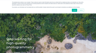
We’re building a brand-new automatic flight control, navigation, and image capture app for drone photogrammetry and we’re looking for pilots to beta test it. Here are five reasons you need to sign up literally right this minute.
Introduction
Hold on, let me get this straight… you need reasons to take your drone to the park on Sunday and use cutting-edge flight control software to generate 3D digital twins that you can then email to your friends, all while bragging that you are helping usher... -
3 years
Terrain following is an important feature for drone flight planning software, but not all apps on the market support it. Pilots should understand how it works to maintain regulatory compliance and capture high-quality image sets.
Introduction
Flight planning, automation, and image capture apps are essential tools for professional drone mappers. They save time and battery life, reduce pilot workloads, and enhance image quality. But many options on the market are designed to automate flights... -
4 years
How to Select a Mapware Pricing Plan
A guide for selecting the drone photogrammetry price plan that works best for your business
Last September, Mapware introduced a Pay-As-You-Go pricing model in which customers could pay 2¢ per megapixel (MP) to process drone imagery in our photogrammetry engine. This was a great, no-strings-attached way for individual drone pilots, infrequent... -
4 years
Mapware’s Photogrammetry Pipeline, Part 5 of 6: Fusion
In the fusion step of the photogrammetry pipeline, Mapware merges all its depth maps together into a dense 3D point cloud and orients it in real-world space.
Photogrammetry pipeline so far
In the previous pipeline step, Mapware used spatial estimates from its sparse 3D point cloud along with metadata from each raw image to generate depth maps showing the elevation of each image pixel. This vastly increased the density of Mapware’s 3D data...
Domain history
| Web host: | Google LLC |
| Registrar: | |
| Registrant: | REDACTED FOR PRIVACY (c/o whoisproxy.com) |
| Updated: | May 24, 2025 |
| Expires: | June 03, 2026 |
| Created: | June 03, 2014 |
Whois record
Safety scores
Trustworthiness
N/AChild safety
N/A